Carriacou island
Ultimate guide (December 2025)
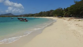
Carriacou is the second largest island of Grenada, as well as the southernmost of Grenadines. In fact, this is a beach capital of the country, as well as an iconic downshifting destination. There are also few small islets scattered around, thus giving great opportunities for those traveling by yacht. However, local beaches are rather mediocre, while average price tag is cheap only by the American standards. There are no any sightseeing as well, - except for the two shipwrecks. The key feature of the island is that it is a convenient starting point to visit magnificent Grenadines. These are located just nearby, though in another country. Shore and seabed: sand, stones. [edit]
Coordinates: 12.480879, -61.45849
See also: Best beaches in Carriacou island
Hotels [edit]
Most Carriacou hotels are located to the north of the airport. The choice of accommodations is limited, while fares are high enough. However, the minimum rooms' rate starts from US$70 per night, that is very cheap by the standards of Grenadines.
How to get there [edit]
Fly to Grenada international airport (GND), next fly to Carriacou island airport (CRU).
When to go [edit]
The best time for a holiday on the beaches of Carriacou island is a dry period from January to June.Rainfall, mm

Water temperature, C

Temperature, C

Humidity, %

Wind speed, meter/sec


